File:United States (orthographic projection).svg

Size of this PNG preview of this SVG file: 541 × 541 pixels. Other resolutions: 240 × 240 pixels | 480 × 480 pixels | 768 × 768 pixels | 1,024 × 1,024 pixels | 2,048 × 2,048 pixels.
Original file (SVG file, nominally 541 × 541 pixels, file size: 396 KB)
'Oto'otoga
| Description |
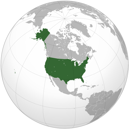
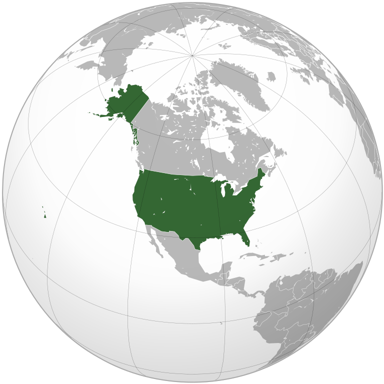
English: The United States
Esperanto: Loko de Usono sur la terglobo |
||||
| Date | |||||
| Source |
Own work, This W3C-unspecified vector image was created with Inkscape . Aquarius.geomar.de
|
||||
| Author | Ssolbergj |

.svg)
Licensing
I, the copyright holder of this work, hereby publish it under the following license:
This file is licensed under the Creative Commons Attribution 3.0 Unported license.
- You are free:
- to share – to copy, distribute and transmit the work
- to remix – to adapt the work
- Under the following conditions:
- attribution – You must give appropriate credit, provide a link to the license, and indicate if changes were made. You may do so in any reasonable manner, but not in any way that suggests the licensor endorses you or your use.
File history
Click on a date/time to view the file as it appeared at that time.
| Date/Time | Thumbnail | Dimensions | User | Comment | |
|---|---|---|---|---|---|
| current | 00:36, 2 Oketopa 2009 | | 541 × 541 (396 KB) | Raeky | try again |
| 00:33, 2 Oketopa 2009 |  | 541 × 541 (395 KB) | Raeky | seems I broke something, hmm | |
| 00:33, 2 Oketopa 2009 |  | 541 × 541 (113 KB) | Raeky | making Manitoulin Island gray colored, part of Canada | |
| 22:40, 21 Oketopa 2008 |  | 541 × 541 (395 KB) | Ssolbergj | {{Information |Description= |Source= |Date= |Author= |Permission= |other_versions= }} | |
| 23:59, 20 Oketopa 2008 |  | 541 × 541 (717 KB) | Ssolbergj | {{Information |Description={{en|1=The United States}} |Source=Own work, {{Inkscape}}<br />[http://www.aquarius.geomar.de/omc/make_map.html Aquarius.geomar.de]<br />{{GFDL-GMT}} |Author=Ssolbergj |Date=21 October 2008 |Permission= |other |
File usage
There are no pages that use this file.
Global file usage
The following other wikis use this file:
- Usage on ady.wikipedia.org
- Usage on af.wikipedia.org
- Usage on ar.wikipedia.org
- Usage on ar.wikinews.org
- Usage on ar.wiktionary.org
- Usage on av.wikipedia.org
- Usage on azb.wikipedia.org
- Usage on az.wiktionary.org
- Usage on ban.wikipedia.org
- Usage on ba.wikipedia.org
- Usage on be-tarask.wikipedia.org
- Usage on be.wikipedia.org
- Usage on bjn.wikipedia.org
- Usage on bs.wikipedia.org
- Usage on cbk-zam.wikipedia.org
- Usage on ch.wikipedia.org
- Usage on ckb.wikipedia.org
- Usage on cs.wikipedia.org
- Usage on cu.wikipedia.org
- Usage on de.wikipedia.org
- Usage on de.wiktionary.org
- Usage on dsb.wikipedia.org
- Usage on dty.wikipedia.org
- Usage on el.wikipedia.org
- Usage on en.wikipedia.org
- Nuclear weapons of the United States
- Wikipedia:Userboxes/Music/Artists
- List of sovereign states and dependent territories in North America
- Outline of the United States
- Fishing industry in the United States
- Talk:European Union/Archive 22
- User:Deluca.michael1996
- User:ZenCopain/1976 (United States)
- Wikipedia:Graphics Lab/Illustration workshop/Archive/Oct 2009
- User:Spacestoned/Artifact-03
- User:Feroang/sandbox
- User:Thepaulba
- User:Aria1561
- User:NiklawskiMSTM/Userboxes
- Talk:United States/Archive 64
- Talk:United States/Archive 81
- User:Always forever
- Talk:European Union/Archive 30
- User:Jogosoccer
- Africa–United States relations
View more global usage of this file.
.svg)
.svg)