File:Portuguese Districts Map With Names.svg

Size of this PNG preview of this SVG file: 415 × 599 pixels. Other resolutions: 166 × 240 pixels | 332 × 480 pixels | 532 × 768 pixels | 709 × 1,024 pixels | 1,419 × 2,048 pixels | 474 × 684 pixels.
Original file (SVG file, nominally 474 × 684 pixels, file size: 173 KB)
'Oto'otoga
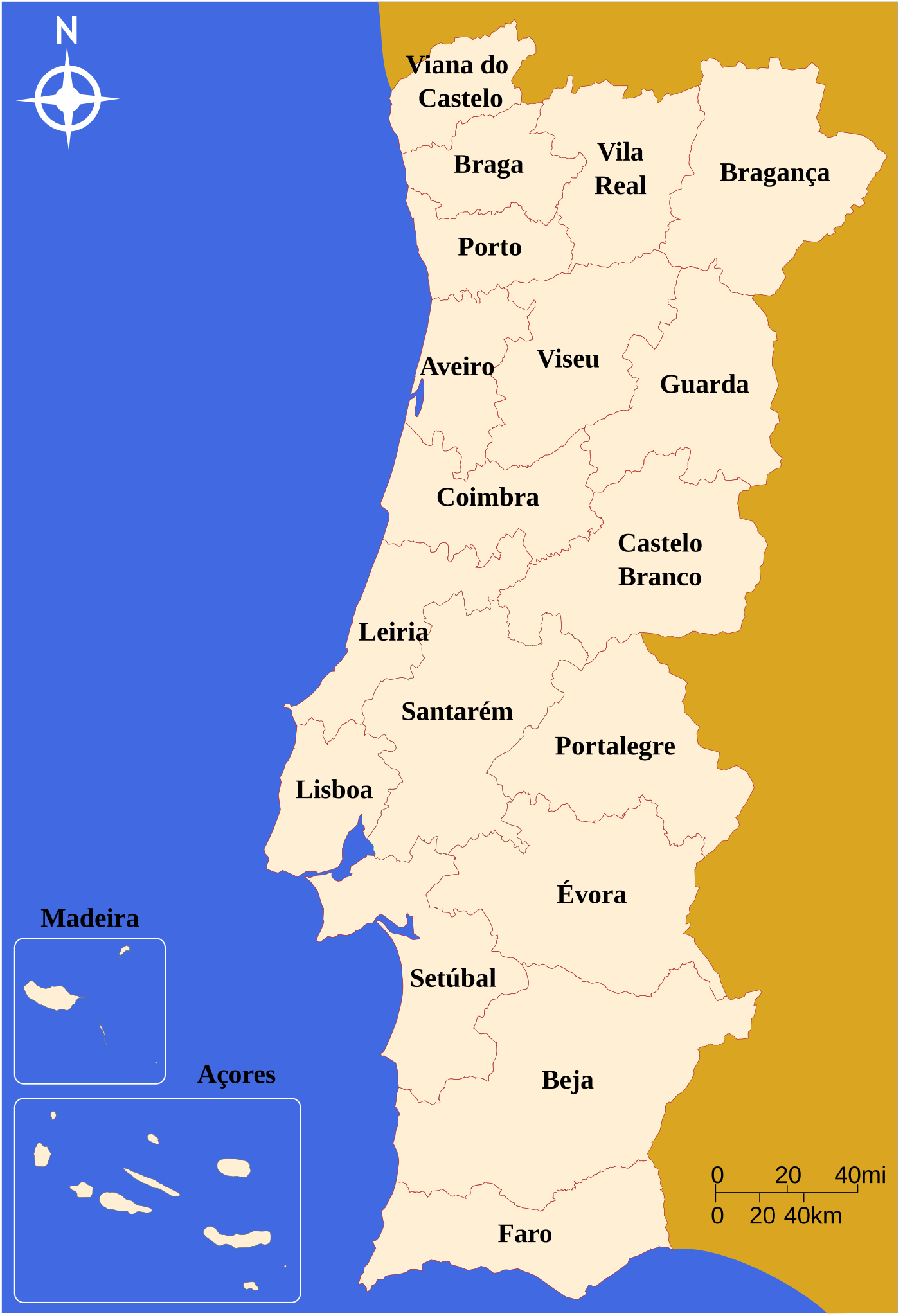
| Description | Map of Portuguese districts with names |
| Source | Own work |
| Author | Paclopes |
Licensing
| I, the copyright holder of this work, release this work into the public domain. This applies worldwide. In some countries this may not be legally possible; if so: I grant anyone the right to use this work for any purpose, without any conditions, unless such conditions are required by law. |
File history
Click on a date/time to view the file as it appeared at that time.
| Date/Time | Thumbnail | Dimensions | User | Comment | |
|---|---|---|---|---|---|
| current | 05:03, 10 Novema 2023 | | 474 × 684 (173 KB) | Heitordp | Added accent to Setúbal |
| 18:45, 14 Me 2013 |  | 474 × 684 (173 KB) | Tm | Reverted to version as of 22:19, 14 October 2007 Please upload your new file under a diferent filename (please see Commons:Overwriting_existing_files#DO_NOT_overwrite | |
| 17:07, 14 Me 2013 |  | 465 × 680 (162 KB) | Huhsunqu | Cambio de colores | |
| 22:19, 14 Oketopa 2007 |  | 474 × 684 (173 KB) | Paclopes | {{Information |Description=Map of Portuguese districts with names |Source=self-made |Date= |Author= Paclopes }} |
File usage
The following page uses this file:
Global file usage
The following other wikis use this file:
- Usage on az.wiktionary.org
- Usage on br.wikipedia.org
- Usage on ce.wikipedia.org
- Usage on cs.wikipedia.org
- Usage on da.wikipedia.org
- Usage on de.wikipedia.org
- Usage on en.wikipedia.org
- Usage on es.wikipedia.org
- Usage on eu.wikipedia.org
- Usage on fi.wikipedia.org
- Usage on fr.wiktionary.org
- Usage on gl.wikipedia.org
- Usage on he.wikipedia.org
- Usage on id.wikipedia.org
- Usage on mni.wikipedia.org
- Usage on pt.wikipedia.org
- Organização territorial de Portugal
- Distritos de Portugal
- Categoria:Distritos de Portugal
- Categoria:Municípios de Portugal
- Categoria:Localidades de Portugal
- Categoria:Freguesias de Portugal
- Associações de futebol de Portugal
- Predefinição:CatPorDis
- Usuário(a):Pla y Grande Covián
- Lista de áreas protegidas de Portugal
- Usage on rm.wikipedia.org
- Usage on ro.wikipedia.org
View more global usage of this file.